THE TEJIDO GROUP
school of landscape architecture university of arizona

LAND USE ANALYSIS
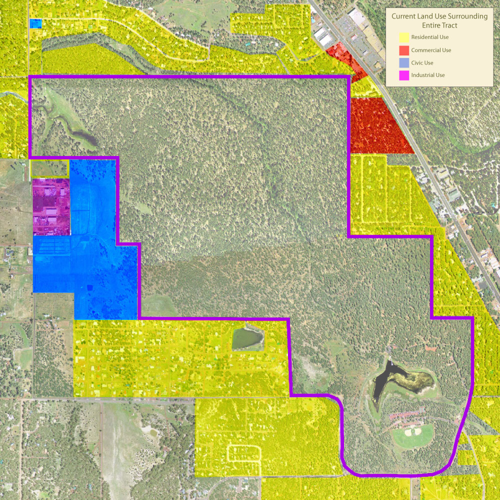
This map illustrates how the Woodland Lake Park Tract is an island in the middle of town. The yellow areas represent properties zoned residential with structures on them that border the tract. One property is zoned residential on the west side of the tract adjacent to Big Springs Environmental Study Area which has no structures. Commercially zoned properties are indicated with red and are located off of Highway 260. The larger red area is the location of two cabin resort businesses which see higher traffic than residential areas but not as much as other businesses. The Mountain Meadow Recreation Complex is indicated by the blue area. This 50 acre parcel is owned by the Town of Pinetop-Lakeside. MMRC sees high use in the warmer months for sports, festivals, and disc golf. The town's parks and recreation department have plans to add lights to the fields in summer 2007. An industrial complex sits adjacent to MMRC and is indicated with purple. A collision shop, an automotive repair shop and a window/door business are located here.
click on image for larger view
university of arizona | school of landscape architecture | the tejido group | contact
webdesign by chris rose