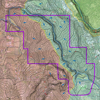
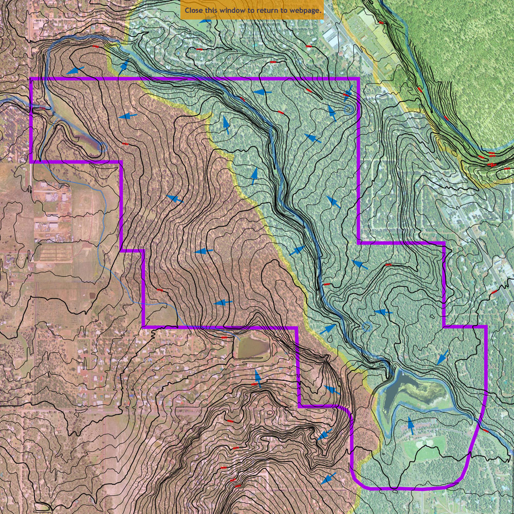
 The topography of the Woodland Lake Park Tract determines the flow of ground water within the Tract. This information is valuable for this study as it guides us in our design process. It is very important for us to maintain the health of the creek systems in Pinetop-Lakeside. They are vital on an ecological and a social basis as the town plans to move forward. The topography has some significant changes within the tract. Elevation changes at the creek are as much as 30 feet, critical information when it comes to siting new facilities.
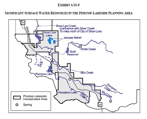
Surface water resources are important to the Town’s economy, aesthetics, and environmental quality. The two major creeks within town limits, Walnut Creek and Billy Creek, are tributaries of Show Low Creek, which is in turn a tributary of Silver Creek. Streams in the area are fed directly by precipitation and by discharges from the Pinetop-Lakeside aquifer through springs and seeps. The numerous springs have played an important role in the cultural development of the region, historically supplying water for irrigation, domestic, recreation, and livestock purposes. Three springs lie within the Tract, Big Springs, Adair Spring and Walnut Spring. Big Springs, the largest group of springs in the area, supplies water to the Big Springs Natural Area, Walnut Creek, and Rainbow Lake. According to the USFS Big Spring is the most viable in the Tract. Adair Springs, piped from the source provides water to minor irrigation uses in addition to eventually supplying some of the water in Rainbow Lake.
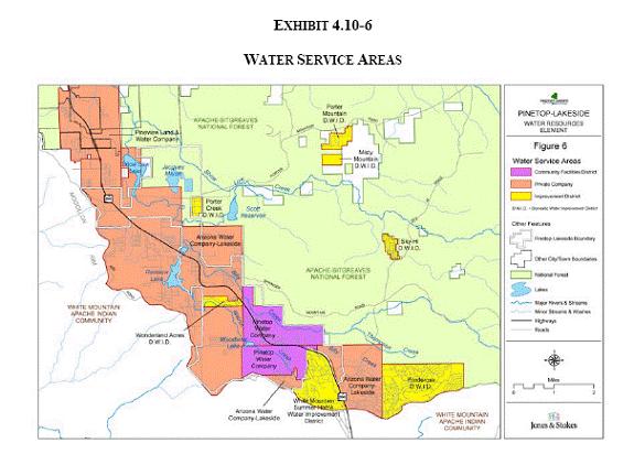
Show Low Pinetop Woodlands Irrigation Company is the modern name for the entity that holds the water rights to the surface water from Woodland Lake, Walnut Creek, and Big Springs. For a period of time, the Show Low and Pinetop Woodlands areas were separate companies; their recent reunification has provided for a common set of rights for all users on the same watershed. There are 48 shareholders in the Pinetop area, and 31 in the Woodland area. The irrigation season actually refers to a limited number of hours when irrigation occurs (312 hours of water in the Pinetop area and 181 hours in the Woodland area). There are no plans to add any new areas, pipes, or ditches to the irrigation district. All irrigated lands are directly adjacent to the system. When irrigated acreage is sold to become a subdivision, its shares may be distributed in the subdivision. Usually a few of the new lot owners purchase the shares, rather than all owners receiving proportionate shares. As a practical matter, the shares may not be broken down into increments smaller than 1 hour.
The irrigation season is for a limited time period early in the year. Once the season ends, the water is permitted to flow from Pinetop ditch to Woodland and Rainbow Lakes until those lakes spill over. Approximately 3 miles of the irrigation system has been converted from ditches to closed pipes. Piping has corrected seepage loss from the ditches, and is beneficial for irrigation purposes as a low-maintenance solution, with little evaporation and no opportunity for water theft.
Lakeside Irrigation System is an irrigation district dating from the early 1900’s that derives its flow from Adair Spring, in the Walnut Creek watershed. There are 45 shareholders who hold 360 share hours in total. The district has no plans for changes to its current area or configuration. The majority of the system is piped, beginning at the spring and continuing to the northwest. The irrigated lands are east of Rainbow Lake, on the east and west side of highway 260. Lakeside Irrigation System does not provide water for any other purpose, such as the recreational lakes.
Irrigated lands are still used for pasture, orchards, and gardens. The amount of commercial agriculture is declining, yet some townspeople are part-time commercial farmers. Two of the springs yield water of a quality that is appropriate for domestic use, but the amount of water is too little for the springs to be seriously considered as a domestic water source. Occasionally the springs have periods of no flow, particularly in times of extended drought.
Information obtained from http://ci.pinetop-lakeside.az.us/genplan/4-10waterresourceselement.pdf

 The topography of the Woodland Lake Park Tract determines the flow of ground water within the Tract. This information is valuable for this study as it guides us in our design process. It is very important for us to maintain the health of the creek systems in Pinetop-Lakeside. They are vital on an ecological and a social basis as the town plans to move forward. The topography has some significant changes within the tract. Elevation changes at the creek are as much as 30 feet, critical information when it comes to siting new facilities.