


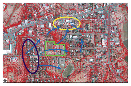
Downtown Show Low, in particular along the Deuce near 8th street and eastward, experiences flooding during rain storms from runoff originating farther to the west near the D. D. Furniture shopping center and points south (the ridge, circled in dark blue, being the high point in this part of town). As noted in the topographical diagram to the right, the surface water (in blue arrows) flows north and east toward the area highlighted as an orange/tan oval. The campus is outlined in light green. |
 |
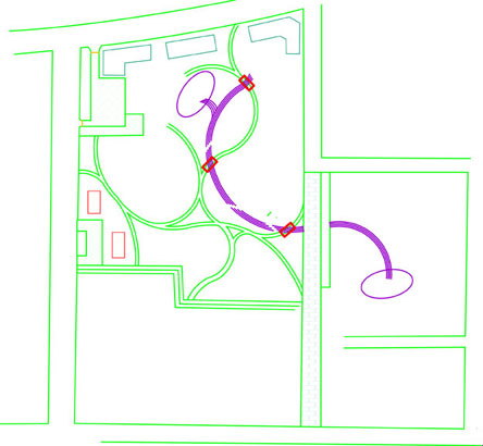
Several residents and business owners have noted the inadequacy of the drains in this area. The conceptual development (shown in a simplified drawing to the right) of the area immediately to the north of the proposed campus includes a water-harvesting and water-control component to help alleviate flooding and drainage issues in downtown. THE SWALE (shown as a purple curve in the illustration to the right) is designed to resemble a dry streambed, with rocks, boulders, and riparian vegetation that meanders through the northern expansion site. It would average 2 -3 feet in depth and approximately 6 feet in width, and be situated at the bottom of the steep slope indicated in the diagram above (the area just north of the campus outline). Water coming from the surface runoff would be captured by this swale system and channeled to a pair of retention basins on either end. |
 |
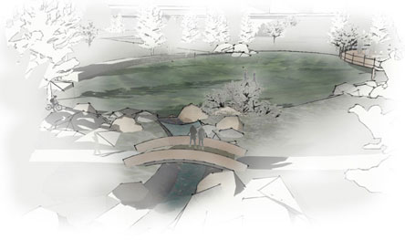
RETENTION BASINS When the basins are dry, they make for excellent sports fields and open park areas for a variety of activities. Because they are sunken into the ground compared to the area around them, these basins could also serve as a kind of amphitheater with decks overlooking the field. |
|
The image to the right illustrates several components of the potential northern expansion area:
|
 |
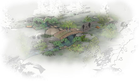
To the right is a birds-eye view of the bridge, swale, pathway, and vegetation with seating in the pleasant microclimates. |
 |
![]()