


 |
|
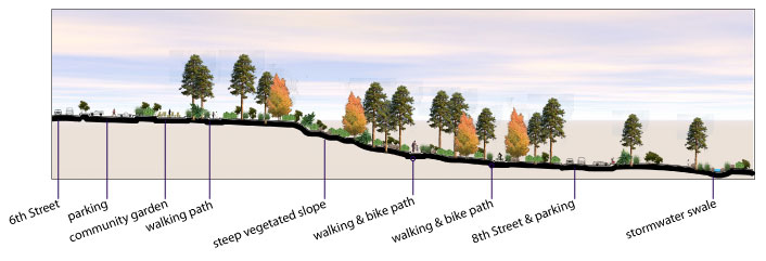
The above section illustrates an east-west section of the northern expansion site between 6th and 8th streets. At the west end is a small parking area for faculty, staff, and visitors to the campus. Students would ideally park in one of the proposed nearby parking garage or utilize the on-street parking, and would walk along the meandering pathways to the campus. The steep slope in the center of this site is heavily vegetated with Ponderosa pine and other native plantings, and leads into the Botanical Garden area. At the opposite end is 8th street with roadside parking. Beyond lies another swale to collect stormwater runoff that leads to a retention basin between Huning Street and City Hall. Again, a 5000 - 10,000 gallon cistern could be located underneath the basin that would be recharged by its water after storms and used for irrigation and/or water features when needed. |
|
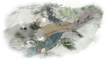 |
The image to the left shows closer illustration of the Community Garden space and where the pathway intersects with the swale a small bridge is provided to pass over the swale. There are numerous seating areas near these nodes and scattered throughout the vegetated areas. Each path averages 8-12 feet in width to accommodate both walking and biking; the paths may be divided in the center by vegetation to separate the two user groups. |
![]()